


Lidar is a new map layer in HiiKER that shows the shape of the ground in extraordinary detail — every gully, bank, crag and old track. It’s a powerful tool for route-finding on open ground, and it often reveals features you won’t see on any other map.
How to turn on Lidar
- Open a map in the HiiKER app.
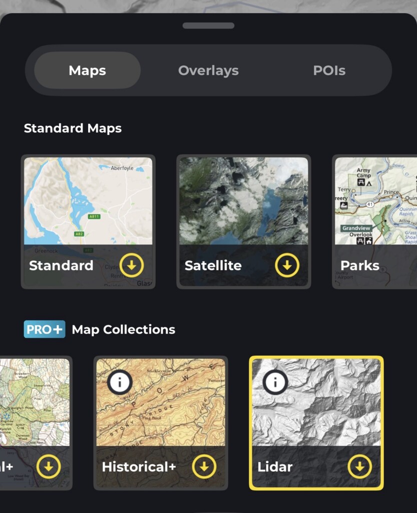
- Tap the “Maps” button.
- Choose Lidar from the list of map layers (Available in the PRO+ collections > Scroll to right)
The map will redraw using the Lidar layer. Your route, waypoints and recorded track all stay visible on top, and you can switch back to your previous layer at any time using the same Maps button.
What are Lidar maps?
Lidar (Light Detection and Ranging) data is collected by aircraft firing laser pulses at the ground and measuring how long they take to bounce back. The result is a highly accurate 3D model of the terrain, usually with a resolution of a metre or better.
Because the survey can filter out trees, buildings and vegetation, a Lidar map shows the bare earth beneath. HiiKER renders this as a shaded relief image, so you see the land as though it were lit by low sunlight.
In practice, that means you can pick out:
- Faint and unmarked paths, old tracks and sunken lanes
- Gullies, streambeds, ditches and drainage lines
- Crags, boulder fields, steep breaks in slope and cornice-prone edges
- Field boundaries, walls, banks and quarry workings
- Archaeological features such as ringforts, cairns and hut circles
These are all things that a standard topographic map generalises away, and that aerial imagery hides under tree cover.
Tips for getting the most out of it
- Use it alongside a standard map, not instead of one. Lidar shows the shape of the land, but no detailed labels, place names or rights of way. Flick between Lidar and your usual layer to get both.
- Zoom in. The detail only really appears at closer zoom levels.
- Trust the ground over the line. If a marked path looks like it’s crossing a steep gully on the Lidar layer, it’s worth planning an alternative.
- Check it before you go. Lidar is excellent for spotting the practical line up a hillside, or an easier way through a broken slope, while you’re still at home.
