

Peak Viewer answers the question “what’s that mountain?”. 3D maps just tilt the terrain. They’re separate features, and it’s easy to mix them up because Peak Viewer uses 3D terrain too.
What Peak Viewer does
It’s a HiiKER PRO+ feature with two views:
- Camera view — hold your phone up to the horizon and every summit in view is labelled with its name and height. Tap a label for the full details on that peak.
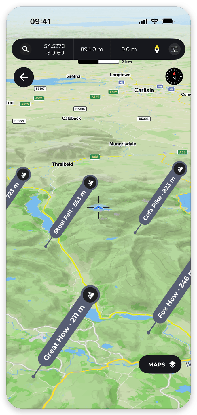
- Peaks on 3D terrain — a map view you can tilt around a range to read the summits off the relief, without having to be standing in front of them.
Tap the map button in Peak Viewer to move between the two.
How to open it
On any map, tap Options and choose Peak Viewer (under Tools). It’s also available as a Quick action (Open Peak Viewer).
How it differs from 3D maps
- 3D maps — the 3D Mode toggle in the Maps window (PRO+) tilts the normal map so you can see terrain relief. It never names anything. See 3D on HiiKER.
- Peak Viewer — identifies and names the summits around you, through your camera or on the terrain map.
- The 3D button on a peak — the free, round 3D button at the top of a peak’s details sheet opens a rotating flyover of that one summit. It doesn’t identify anything; you already know which peak you tapped.
- 3D flyover videos — a different thing again: a rendered video that flies along a route you’ve recorded. You can make one from a recording in the app or on the HiiKER website.
One reason these get confused: the peaks-on-3D-terrain screen inside Peak Viewer uses the same Maps window and the same 3D Mode toggle as the rest of the app. So seeing 3D terrain there doesn’t mean you’re in Peak Viewer — what makes it Peak Viewer is the named summits on top.
Getting the best out of it
- Peaks are found within 60 km of you at most. If you see “No named peaks within…”, there’s nothing named in range. On the terrain map, zooming out too far clears the pins (“Zoom in to see peaks”).
- If the labels don’t line up with the summits, your compass needs help. Move away from metal and vehicles, tap the compass to reset to true north, or drag the screen to nudge the labels into place. The Peak Viewer guide has more tips.
- Use the Range slider to control how far out peaks are shown — handy for cutting clutter on a busy horizon.
- Capture saves and shares a photo of your labelled view.
Do I need PRO+?
Yes. If you’ve seen the “Name every peak you can see” card in the app, its Try it out button gives you one free look — after that, and any time you open Peak Viewer from the map Options menu, it’s a PRO+ feature. The Capture button is PRO+ only, including during the free look.
Terrain data © Mapterhorn.