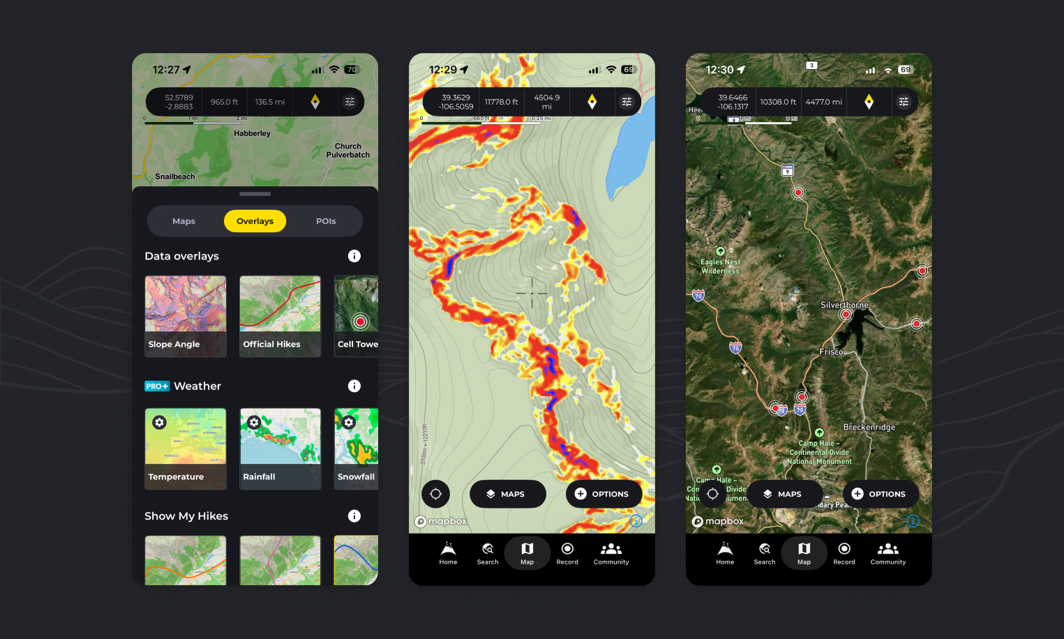
The Overlays tab in your HiiKER map features a Data Overlays section — designed to give you even more control and information when planning or navigating a hike.
Show data Slope angle, cell service and HiiKER hikes map data on the map
- On any map page, tap on the “maps” button and switch to the “Overlays” tab.
- Tap any of the overlay options to show data on the map.
🟡🔴 Slope Angle – Visualize Terrain Steepness
The Slope Angle overlay helps you assess terrain severity at a glance. Using a color-coded system ranging from:
• Yellow (gentle slopes)
• through Red and Purple
• to Black (very steep or dangerous slopes)
…this map highlights areas where extra caution may be needed, particularly on mountainous or winter paths. It’s ideal for risk assessment, route planning, and avoiding unexpected hazards.
📶 Cell Towers – Plan for Connectivity
The Cell Towers overlay displays the locations of nearby mobile network towers. This allows you to:
• Identify where you’re most likely to receive signal
• Choose campsites or rest stops with better coverage
• Locate signal access points in case of emergency
💡 Pro Tip: While terrain and weather can still affect coverage, being aware of the nearest tower gives you a much better chance of reconnecting when needed.
🥾 HiiKER Hikes – Explore with Confidence
With this overlay, you can toggle on all 130,000+ verified HiiKER hike lines right on your map. This is a powerful tool for:
• Visualizing nearby official hikes
• Guiding your hike using verified hike routes
• Plotting your own custom route using trusted hikes as a base
Whether you’re exploring a new area or fine-tuning a hike plan, the HiiKER Hikes overlay ensures you’re never far from a trusted path.
These overlays work seamlessly with our other map layers, including the Basic and PRO+ maps — offering an enhanced, data-rich hiking experience.
How can I see all of the HiiKER hikes on one map?
You can view the entire collection of HiiKER hikes on your map by activating the “Official hikes” overlay as instructed above.
How can I view slope angle on the map?
By following the steps above and activating the “Slope Angle” overlay you will see a colored representation of steep elevation on the the map
How can I check cell coverage / Network coverage on HiiKER?
By activating the “Cell Tower” overlay as instructed above, you can see cell tower locations, giving you a better indication of network availability in the area.