On any HiiKER map, you can unlock a world of useful points of interest, like accommodations, peaks, shops, transport stations, historical sites and more, just for hikers and outdoor adventures.
To show POIs on the map:
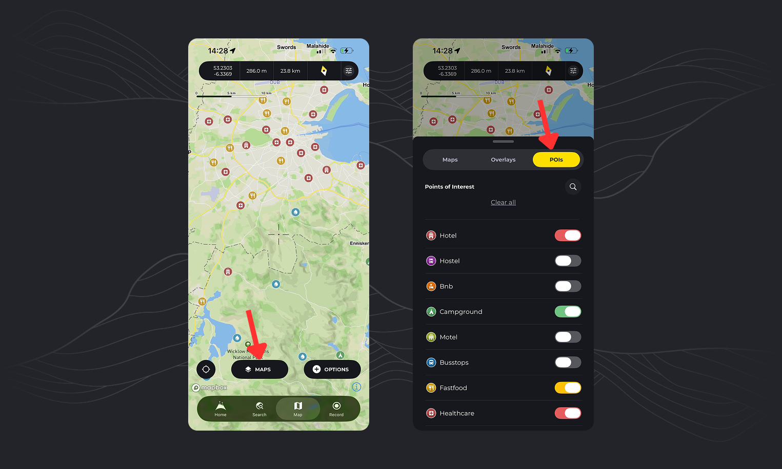
- Tap the “Maps” button and then tap on the “POIs” tab for a full list of available categories.
- Activate the category that you want to see added to the map. You can also search for categories, and clear all POIs to quickly tidy up your map.
For more information on each POI, tap the icon on the map to reveal an information sheet. From here you can see contact information, location data and well and images and reviews where available.
How to see campgrounds on HiiKER

- Tap the “maps” button
- Select the POIs tab
- You can search the list for “Campgrounds”
- Activate the toggle switch to show campground locations on the map
How to see water stops on HiiKER

- Tap the “maps” button
- Select the POIs tab
- You can search the list for “Water”
- Activate the toggle switch to show water refill locations on the map
How can I save a POI to my Waypoints

- Add POIs to the map
- Tap on the POI to reveal more information
- Select the “Add to Waypoints” option.
- This is a easy way to build up a collection of your own waypoints for your hikes
How can I view POIs in street view
