


Peak Viewer uses your phone’s camera to name the peaks around you. Point your phone at the horizon and every summit in view is labelled with its name and height.
What it does
- Labels the peaks you can see through your camera with their names and heights.
- Uses HiiKER’s AI continuous alignment technology to snap to the mountains.
- Opens the full details for any peak when you tap its label.
- Lets you capture the view, labels included, and share it.
Requirements
- Minimum app versions. iOS: 26.101, Android: 26.10.2
- A HiiKER PRO+ subscription. New users can try Peak Viewer once for free.
- Camera, location and compass access.
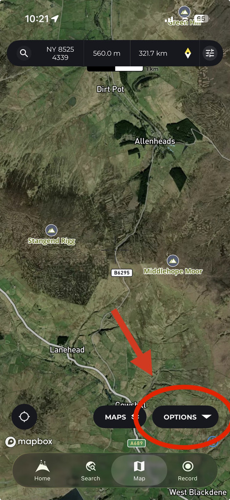

Where to find it
- Open any map page in the app that features the “Options” button.
- Tap Options.
- Tap Peak Viewer.
You can also add Peak Viewer to a quick action button on the map for one-tap access.
How to use it
- Hold your phone up and point the camera at the horizon.
- Wait a moment while HiiKER finds the peaks near you.
- Move your phone to line up the horizon. Labels appear over each summit.
- Tap a label to see that peak’s details.
Additional options
- Range: Use the slider to choose how far to look for peaks, from 5 km to 60 km. The default is 30 km.
- Overlay style: Show or hide the horizon line.
- Show peaks: Turn the peak labels on or off.
- Zoom: Pinch with two fingers to zoom in on distant peaks.
- Capture: Save and share a photo of the view with the peak labels.
Labels not lining up with the mountains?
Sometimes the labels and horizon line sit a little to the side of, or above or below, the real mountains. This is normal, and it only takes a few seconds to fix.
Why it happens
Peak Viewer doesn’t recognise mountains in the camera picture. It works out what’s in front of you from your location, the direction your phone is pointing and a 3D map of the terrain. If any of those are slightly off, the labels will be too.
- The compass is off or misaligned. Phone compasses are easily thrown by nearby metal, such as a car, a fence, trekking poles, a magnetic phone case or a mount. Even a few degrees out moves the labels sideways. Sitting in your car is a common way to trigger a misalignment.
Note: Move your phone in a slow figure-of-eight to recalibrate the compass - The phone’s tilt sensor is off. This can make the horizon line sit too high or too low.
- Your location is rough. In a deep valley, a forest or right after you open the app, GPS can be less accurate. This matters most for nearby peaks.
- You can’t see the real skyline. Cloud, mist, haze or low light can hide the summits. Peak Viewer still labels the peaks behind the cloud, but there’s nothing to compare them with, so they can look like they’re floating in the sky.
- A closer hill is in the way. A nearby ridge or trees can block the bigger peaks behind them.
How to fix it: drag to line it up
You can move the labels by hand so they match the mountains you can see.
- Turn on the horizon line (Overlay style), so you have a clear outline to match.
- Pick a peak or ridge you can see clearly.
- Place one finger on the screen and drag. Drag left or right to move the labels sideways. Drag up or down to raise or lower the horizon.
- Let go when the horizon line sits on the real skyline. All the labels move together, so once one peak lines up, the rest follow.
Peak Viewer remembers your up and down adjustment next time you open it, because that error usually comes from the phone itself. The sideways adjustment starts fresh each time, because the compass can change from place to place.
Starting again
- Tap Options then Reset Horizon, to clear your adjustments.
- Tap the compass at the top of the screen to go back to true north. This clears the sideways adjustment only.
Other tips
- Step away from cars, fences and other metal, and take your phone out of any magnetic case or mount.
- If the app says compass accuracy is low, move your phone in a slow figure-of-eight to recalibrate the compass.
- Wait a few seconds after opening Peak Viewer so your location can settle.
- Hold your phone upright and level.
- In cloud or poor light, line up on any landmark you can see. The other labels will still be in the right place relative to it.
- If no peaks show up, try increasing the range.
- Its recommended that “Continuous alignment (Beta)” and “Frame locked Overlay (Beta)” remain active for best chance of a successful alignment.
