

📱 Looking to do this in the HiiKER app? See GPX Files on HiiKER.
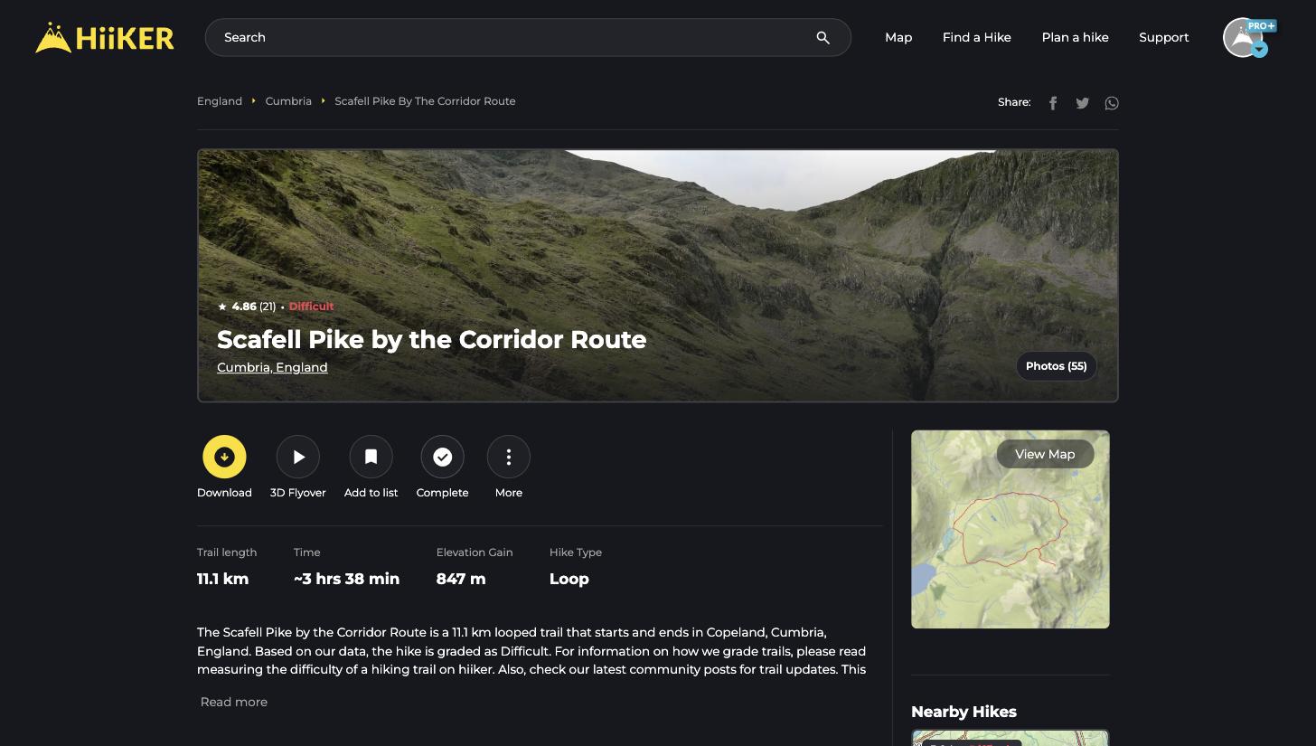
Every trail on HiiKER has its own hike page — the overview of everything you need to decide, plan, and get going. Here’s what you’ll find on one, using Scafell Pike by the Corridor Route as an example.
In this article: The essentials · Action buttons · Downloads & devices · Reviews & recordings
The essentials at a glance
At the top you’ll see the hike’s star rating, difficulty grade, and photo gallery, followed by the key stats: Trail length, estimated Time, Elevation Gain, and Hike Type (loop, out and back, or point to point). Below that, the description, What to expect tags, and activity types tell you what the trail is like on the ground. On the right, View Map opens the full-screen map, with Nearby Hikes below it.

The action buttons
- Download — send the hike to your phone, export it as a file, or send it to a Garmin device (see below).
- 3D Flyover — watch a 3D fly-through preview of the whole route.
- Add to list — save the hike to one of your hike lists.
- Complete — mark the hike as done and log the date.
- More — copy and edit the route in the planner, print a map (PRO+), embed the map on your own website, share, or report an issue.
Get the hike onto your phone or device
Click Download to open the transfer window:
- Send to phone — scan the QR code or text yourself a link that opens the hike in the HiiKER app.
- Export File — download the route as GPX, GPX for Garmin, KML, or GeoJSON.
- Send to Garmin — push the route straight to a connected Garmin device.

Comments, reviews and recordings
Further down the page you’ll find reviews from other hikers — many with their actual GPS recordings attached, so you can see exactly how long the hike took them and view their track. Click Comment on this hike to leave your own rating, photos, and trail updates (you’ll need to be logged in).

💡 Top tip: Want to tweak the route? Open More → Edit a copy to load the hike into the Hike Planner and make it your own.
